Thursday, November 17, 2011

The Dusun - A Pictorial Documentary

By Joseph Pirin


I'm hereby initiating a post about one of my holidays side-study, an anthropological approach towards my native ethnic history and its legacy. This is the first post concerning such specified subject, The Dusun.

In this post, I'm largely depends on a single book which I considered it to be among the earliest well-written account regarding The Dusun prior to their conversion into christianity and other major religion. The book is written by Ivor H. N. Evans, B.A. entitled "Among Primitive Peoples in Borneo" that published in 1922. In fact, this book is published 89 years ago during the period of British North Borneo Chartered Company rule, long before the outbreak of World War 2 and Independence of Sabah (North Borneo). Thus, at all means, this post is also considered to be a loosely version of book review by myself. Any futher question circulating your mind will surely be answered by reading the entire book by yourself. ;p

The front page of the book by (Evans, 1922)

Before I start this so-called pictorial documentary, it's good to give some of the biography of the author; Ivor H. N. Evans, B.A.

Ivor Hugh Norman Evans was a fellow of the Royal Anthropological Institute. Ivor Evans (1886-1957) was a British anthropologist, ethnographer and archaeologist who lived and worked in Malaya and North Borneo (now Malaysia), and became a Gypsy Lore Society member in 1927. During periods of leave in England, Evans visited Gypsy sites and families around the South-East and East Anglia, photographing the families he met. He retired to Suffolk in 1933, but decided to return to Borneo permanently in 1938. Evans was educated at Charterhouse School in Godalming (Surrey) and at Clare College, University of Cambridge. After a brief spell as a cadet in the British North Borneo Company's Service (1910-1911), he was employed as a curator in Malaya for twenty years (1912-1932), spent mostly at the Perak Museum in Taiping. He retired in 1932 and settled at Oulton Broad in Suffolk until 1938. He then returned to Borneo, where he spent the remainder of his life. Detained by the Japanese in Kuching during the war years (1942-1945), he died in Labuan on May 3, 1957. Evans has written numerous books including Brewer's Dictionary of Phrase and Fable (Revised edition in 19??), Studies in Religion, Folklore and Custom in British North Borneo and the Malay Peninsula (1901), Malay arts and crafts (Malayan series) (1923), Papers on the Ethnology and Archaeology of the Malay Peninsula (1927), Negrito of Malaya (1937), The Religion of the Tempasuk Dusuns of North Borneo (1953) and some others selected works and articles. A more detailed biography of him can be seen HERE.

Through the book, Evans particularly study some of the Dusun Village such as Tambatuan, Tambulion, Tempasuk, Tarantidan, Metanau, Kiau, Kaung and Bengkahak in Kota Belud, Tenghilan and Timpalang in Tuaran. Some area like Kolambai at Tempasuk and Mengkabong Water Village, a settlement of the Bajaus was also being studied and also few more places which I'm not stated here.

In my own perspective, he had contribute so much in forming a basis for future generation anthropological research especially his notes/accounts about the Dusun peoples of North Borneo. At the same point, he also had successfully giving an image of the Dusun's life in early 20th century. Of course, there was also some other authors that had done the same but in this post, I'm focusing only this person. Hehe...

Evans, I.H.N., I idolize you. Your writings, your works, your research, all of it was a treasure for the Dusun people of Sabah. This is a quote from the book which I'd remember so much;

"As I am chiefly acquainted with the second type of post, I will confine myself to trying to give some idea of the life there." (Evans, 1922)

The quote was written by Evans after he got the post of an Outstation-Officer, encouraging himself to record any kind of description of Who and What he will encounter afterward.

Note that, I'm not posting all of the picture contains in the book, only certain which I think was interesting to be shared with my fellow Sabahans. 11 pictures out of 21 that exist in the book. All the pictures & its description was picked from the book.


A Lowland Dusun with his buffalo

This ungainly loooking brute is a favourite steed, and can keep up a jog-trot for hours, when it is
not exposed to the full beat of the sun. The animal is "steered" by means of the cord attached to
the nose-ring. A saddle a with a high wooden peak is generally used in buffalo-riding.


Gumpus, The Headman of Tambatuan, with spear and Pida

He is wearing his headman's badge, received from Government, of which he is very proud. The Pida, a broad-bladed knife, or short sword, is in its origin a Sulu weapon.


A Dusun Family Party on the March

The old man has a spear in his right hand, which he uses as a walking stick, or against a pig,
or other animal he may encounter. The point of the spear is protected by a two-piece wooden sheath bound with strips of rattan cane. Note the inevitable chopping knife on the left thigh.


A Dusun Fish-Trap in the Kadamaian River

A trap of this kind is contructed at the narrow end of two long V-shaped, converging walls of
stones, built in the river bed, and having their larger opening up-stream. It consists of a long
shoot of bamboos leading to a removable, conical basket, into the fish fall.


Dusun Priestess of Tambatuan in Ceremonial Dress

Among the Dusuns, initiated by women plays a prominent part in religious rite, which they conduct in language which is not supposed to be understood by the men. The woman in the picture is holding a divination-stick in her hand.


A Dusun Man of Tambatuan in War Dress

He wears a thick coat of closely-woven fibre, which is fringed at the bottom and trimmed with cowrie shells. The round shield is made of wood, and the sword, suspended from a cowrie-covered bandolier, has a tail of human hair inserted in the pommel.


A Head-House at Kaung "Ulu", Tempasuk District

The basket which the man has removed from the little house, or hut, contains several human skulls and also some of the Orang-utan. When a man was wounded in a fight, but his head not secured, the Kaung people added an ape's skull to the basket as a substitute for the man's.


Drying padi in a Dusun Village

The round trays, ordinarily used for winnowing, contain the grain which is being dried. The old
woman sitting on the boulder has a stick beside her with which to drive away the fowls.


Dusuns of Tempasuk Village, near Kota Belud

Four typical lowland Dusuns in holiday costume. The two men in the centre, Bengali and Gimbad, are old friends of the author.


Some Dusun Musical Instruments

These instruments are ordinarily played together. They consist of a set of duicimer gongs, a drum, a flute, a nose-flute (one nostril is stopped with leaves when playing it), and two stringed
instruments of bamboo, played by women.


The Kaung "Ulu", A Typical Up-country Dusun Village of the Tempasuk District

On the left is a house in course of construction. "House-horns", found on many Dusun dwellings,
can be seen at the apex of the roof in the centre.


My Point of View:

  • Title of the book itself tells us the word "Primitive", it's sounds kind of insulting since we're in a modern world right now...But then, I think we should not be too sensitive with any of the content in the book because it was all a reality in 89 years ago during the book was written by the author. In fact, He is comes up with a more updated study of the Dusun's people in a book, The Religion of the Tempasuk Dusuns of North Borneo which is published in 1953. Note that, We're much much better and well-civilized now compared to 89 years ago.
  • Although the Bajau's, Illanun's (Iranun) and Brunei-Malay of the westcoast of North Borneo were already a Muslim by the time British North Borneo Chartered Company(BNBCC) rule the land, most of the Dusun's people were still pagan though some had already converted to either Christian or Islam.
  • Most of (Evans,1922) accounts are focusing on a Dusun Village in Kota Belud and some in Tuaran which I consider to be incomplete if we're talking about the whole Dusun's community that lived in North Borneo. We must know that he is not covered a study of the Dusun's in Ranau, Tambunan, Keningau, Kudat and some that exist in Kinabatangan plain.
  • During the time of Evans doing his study about the Dusun's in North Borneo, the Bobolian (Dusun Priestess) was still enormous in number whereby every village having a few Bobolian is common.
  • It was interesting when we gettin' to know of what we're wearing in those century back, especially the War-Dress which was arouse the interest of myself. I found that the typical War-Dress was still being displayed today in certain part of Sabah, mainly during a local festival or a visit by tourists. One may find such cloths being displayed in the well-known Monsopiad Cultural Village, Penampang.
  • The Head-house shown above is same as what it's looks like of Head-house in Sunsuron Village, my village in Tambunan prior to the construction of the concrete structure replacing the wooden head-house.
  • Some of the traditional Dusun's music instruments like Sompoton and Gong just to name some; having a long history than I thought before. Being able to survive through a rapid modernization till day was fortunate for us as the new generation.
  • The Tempasuk District which (Evans,1922) refers to might be a sub-district of Kota Belud on that time. Of course I'm not quite sure but Kota Belud is mentioned too in the same book.
  • Tempasuk District was the main study-site of (Evans,1922) which more suitable to be known as Tempasuk Region. He write a more recent updated book 31 years after this book was published, that is The Religion of the Tempasuk Dusuns of North Borneo (1953).

Although, now we live in a modern environment whereby most of the Dusun's people are well-educated, some even migrate to major town and Kota Kinabalu City and achieving top post in the State Government and even in the federal government. I would say, we should not forget our origin and our way of life in the past so that we really know who we are. Without the people of the past, we're none.

"Those who don't know history are destined to repeat it."
(Edmund Burke, {1729-1797})

"Those who cannot remember the past are condemned to repeat it."
(George Santayana, {1863-1952})


The book contains 31 chapters in all which covered a lot of interesting notes/accounts of the peoples of Borneo, focusing on the community that lives in the westcoast of North Borneo (later known as Sabah). Lets take a look of its Table of Content;

CONTENTS:
CHAPTER I - British North Borneo: General Description, History & Government.
CHAPTER II - British North Borneo: Population & Races.
CHAPTER III - Trade & Industries.
CHAPTER IV - The Jungle.
CHAPTER V - The Tuaran & Tempasuk Districts.
CHAPTER VI - Travelling Up-country & Elsewhere.
CHAPTER VII - The Life of an Out-station Officer.

THe DUSUNS:
CHAPTER VIII - Race of The Tuaran & Tempasuk Districts.
CHAPTER IX - Dress & Adornment.
CHAPTER X - Houses, Domestic Affairs & Government.
CHAPTER XI - Agriculture, Fishing, Hunting & Trapping.
CHAPTER XII - Food, Narcotics & Intoxicants.
CHAPTER XIII - Courtship, Marriage & Divorce, Burial & Puberty, Customs.
CHAPTER XIV - Musical Instruments, Music & Dancing.
CHAPTER XV - Wealth, Currency, Trading, Markets.
CHAPTER XVI - Manufactures.
CHAPTER XVII - Religion & Superstitions.
CHAPTER XVIII - Legends.
CHAPTER XIX - Warfare, Head-hunting & Weapons.

THE BAJAUS & ILLANUNS:
CHAPTER XX - Race of The Tuaran & Tempasuk Districts.
CHAPTER XXI - Agriculture, Hunting & Fishing.
CHAPTER XXII - Dress, Domestic Affairs & Government.
CHAPTER XXIII - Food & Intoxicants.
CHAPTER XXIV - Love, Courtship & Marriage.
CHAPTER XXV - Manufactures.
CHAPTER XXVI - Cock-Fighting, Gambling & Other Amusements.
CHAPTER XXVII - Religion & Folklore.
CHAPTER XXVIII - Weapons & Warfare.
CHAPTER XXIX - Antiquities.
CHAPTER XXX - The Chinese in Borneo.
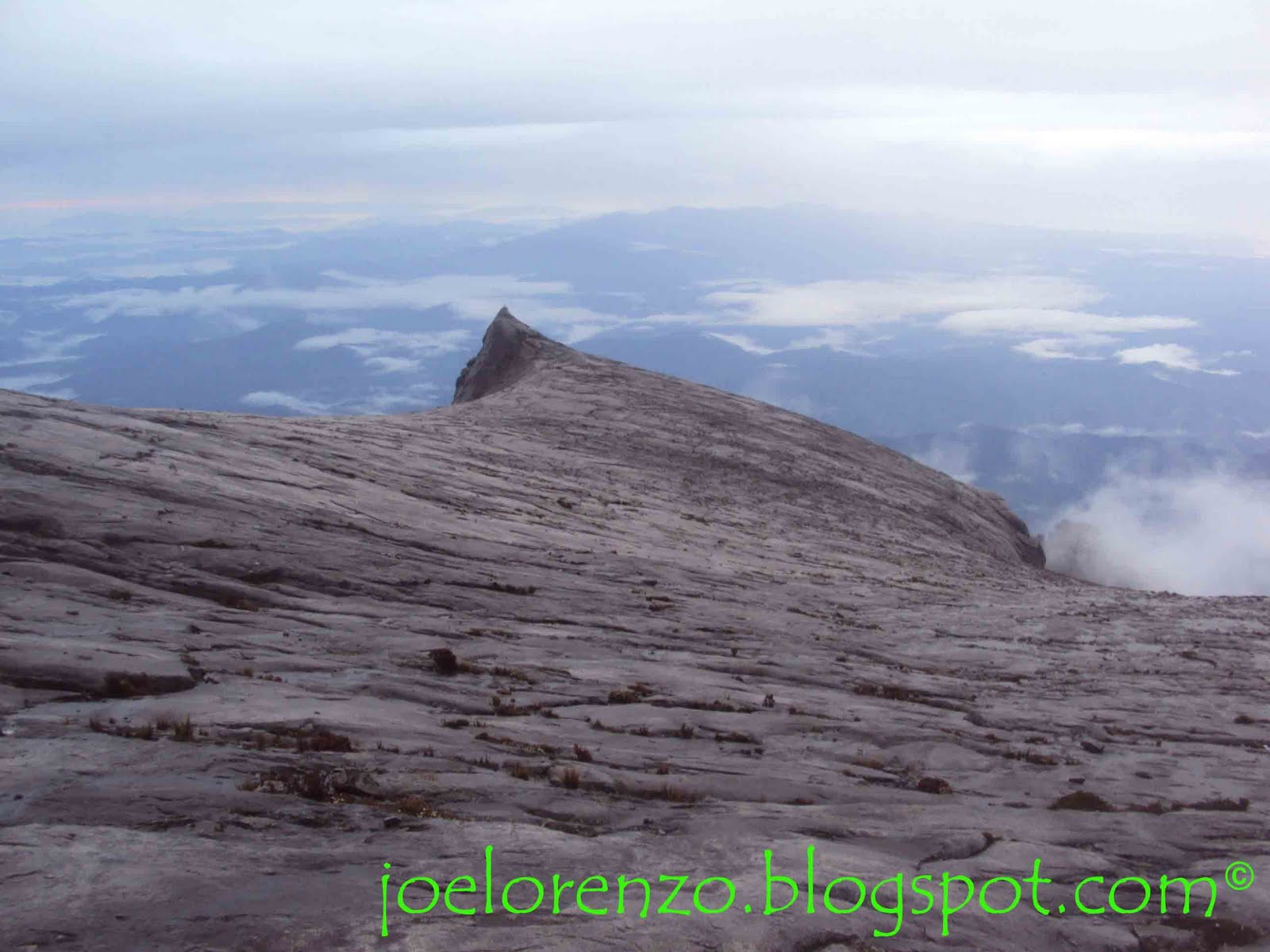
CHAPTER XXXI - Diary of a Journey to Mount Kinabalu.

APPENDICES:
A:Derivations of some Tempasuk Place-Names.
B:Measurements of "Orang Dusun".
C:The Malay Language.
INDEX.


The original copy of this 318 pages book is rather difficult to found nowadays. I'm sure it was out of print already unless if they do a reprint version or whatsoever. So, I guess this book which was published in 1922 was quite rare and one can only found it by chance at overseas library or achive. But, be sure to try check it on the internet as if you're lucky enough to find it. bye2...until next post.


REFERENCES:


Detailed Biography of Evans, I.H.N. (1886-1957)

Evans, I.H.N. 1922. Among Primitive Peoples in Borneo. Seeley, Service & Co. Limited.38, Great Russel Street, London, United Kingdom of Great Britain.

I. H. N. Evans's Bornean Diaries 1938-1942. (Internet Source)

University of Liverpool - Special Collections & Archives. (Internet Source)


All Pictures & Its Description quote is credited to (Evans, 1922).

Sunday, October 23, 2011

Mount Wakid : A Mountain in Sunsuron

By Joseph Pirin

Mount Wakid at Sunsuron
Source : Google Images

Not much idea or story can be told about this so-called Sunsuron mountain, Mount Wakid, as there is lack of literacy writings that mention about it. It is just an ordinary mountain as I could say, not so popular compared to a more superior mountain in Sabah like the majestic Mt.Kinabalu, 2nd highest mountain of Malaysia, Mt.Trus Madi or even maybe Mt.Silam of the eastcoast Sabah. It is a basic knowledge to know that any special mountain should have some significant occuring or some important event that were held there for peoples to know it.

Ok, the idea is; What so special with Mt.Wakid?

Lets take a glimpse of that for a moment...


Mount Wakid is the highest mountain in Tambunan district, it's obvious. This mountain is located at Kg.Sunsuron, Tambunan with an elevation about 2,000 meters high. It was covered with lush thick rainforest. Mount Wakid is considered as a symbol to the people of Sunsuron because the mountain is laid within the Sunsuron area.

According to a web, Asme Wordpress, there are over 300 mountains in Malaysia whereby the top 3 mountain belongs to Sabah which is Mt.Kinabalu (4095m), Mt.Trus Madi (2642m) and Mt.Tambuyukon (2579m). To date, the website had successfully listing out around 308 mountains complete with details such as elevation in feet & meters, location and State. The author of the website wrote,

"This is the most complete list that I could come up with. The above list is by no means complete or perfect."
(Asme Wordpress, September 12, 2009)

Undoubtedly, this is the most complete list of Malaysia mountains that I ever seen. I was amazed when first looking at the list. I was like, " Fantastic! Marvelous! Informative! "... Hahaha... I would say, it was an attempt that shouldn't be wasted for at all cost. Ok, back to track... According to the list, Mt.Wakid is ranked at 31st of the highest mountain in Malaysia and ranked 4th in Sabah. If it's not a mistake, then Mt.Wakid is quite a respectable high really, when its comes to a rainforest-covered mountain.

For your information, the name Wakid was derived from "Wakid", an equipment used for farming activities mainly by KadazanDusun peoples to "sikut" (carry) any affordable goods especially during harvesting season. It is made of poring (Buluh/Bamboo). An early version of Wakid looks like a inverted cone-like shape with additional bag-straps attached to it called togiwis, while modern version of Wakid looks more like a circular pattern basket-like shape with large opening on top and well-made straps attached to it.

Unfortunately for me, it's unknown if there is any connection between the Wakid and the name itself. I might only thinks that the local peoples named it based on their regularly used Wakid. Otherwise, from what I've read here, a "Wakid" is a symbolic native practice in preparing for a meaningful journey.

Considering that Mt.Wakid is the highest spot within Sunsuron, it's possibly had been used as a natural fortress against enemy during the tribal warfare era very long time ago, as Sunsuron laid on a valley surrounded by hills and mountains. It's quite a strategic place actually when we think in a different perspective.

As what I had noticed, most of the Mt.Wakid rainforest was still intact and maintain its original environment despite of the rapid modernization of Sunsuron Village. It is believed that there are many beautiful waterfalls here as an eco-tourism hotspot. Therefore, it has a huge potential of being one of the tourist attraction in this area, thus, indirectly benefiting the Sunsuron Village as it was. I've heard about a Mount Wakid Resort before, but I don't know if it trully exist or not, because I never been there yet.


Any suggestion & recommendation is most welcome...Thanks ^__^
(Note: Correct me if u spotted anything wrong in this article, ok... peace^^ )

The writer of this article, Joseph Pirin, is researching material for a writings on the The Long History of Sunsuron and would appreciate any information or copies of photographs pertinent to this subject. Please contact by Email, josephpirin88@gmail.com


Joseph Pirin 2011©
All right reserved.

Saturday, October 15, 2011

How Sunsuron Got Its Name?

By Joseph Pirin


The Sunsuron Village
Source : Google Images

One may wonder, how the Kg. Sunsuron got its name? hmm... lets see...

It took me over 3 weeks in compiling the theories about How Sunsuron Got Its Name? that scattered all around the internet. Although most of it maybe just a public opinion or traditional story-telling that passed through from a generation to new generation, there might exist some truth in it afterall.

There is no written record on the selected topic of When did the Sunsuron is founded?, thus, the word Sunsuron itself maybe originated from some actual event or significant occurring.

Despite of what I've said in the above sentence, there were actually a statement existed that can be used to relate the topic; When did the Sunsuron is founded?...

An excerpt from a book, The Dusun-A North Borneo Society by Thomas Rhys Williams (1965) is best to describe the possible period of Kampung Sunsuron establishment. Thomas Rhys Williams had resided in Sunsuron Village from September to December 1959, for gathering mythical accounts of the peoples of the area. The research was undertaken as part of a study of the Dusun of North Borneo conducted under auspices of the National Science Foundation (Grant 5-018) (Williams, 1961).

He wrote:
"Prior to 1880 the plain area was unoccupied and appears to have served as a boundary zone and cockpit of head warfare for several local groups. After 1885, native police patrols under European officers of the North Borneo Chartered Company established a tenuous form of order sufficient to allow initial settlement on the northern fringe of the plain. Settlement of the valley floor along the eastward course of the Sunsuron river proceeded rapidly in the years 1900-1925. However, continued fears of head taking slowed settlement of the central and south portions of the Tambunan plain. Those areas, along the southward course of the Pegalan river, were not cleared of primary jungle until the mid 1930s." (Williams, 1965:67)
According to Williams (1965), he stated that there is no village on the Tambunan plain prior to 1880. Only after 1885, then the human settlement is rapidly increased. The Northern fringe of the plain to which he refer possibly includes Sunsuron Village, by accepting the fact that Tambunan Town as the centre of Tambunan Plain. But, as what Phelan tells us, An examination of these statements would probably reveal that Tambunan valley has an older and better developed social history than is suggested by Williams (Phelan, 1994).

Unfortunate to tell that, I'm only discussing the topic based on a secondary data which some people might say not really reliable but indeed the one that I refer to is an absolute account from a first-hand information. With addition of futher research, revise and review, an output of a more detailed account would be a better reference. I'm highly appreciate to those who contribute any other version of theory. Any suitable information will surely being updated later on.

From what I have read in the past few weeks, there were perhaps two different version of theory about the actual origin of the village name. One is written by an official Kg.Sunsuron website and the other one is by Aliran Pemikiran Pendidik Malaysia .

The first theory tells that the name Sunsuron is originated from The Sunsuyon Incident.
The word “bridge” in Kadazan Dusun is sunsuyon. Kampung Sunsuron once had a bamboo bridge built by the villagers to cross the Sunsuron River at that time. The village was initially known as Kampung Sunsuyon, however over the period of time, the name was unintentionally changed to Sunsuron.

While the second theory tells that the name Sunsuron is originated based on the nearby river which is surely refer to the Sunsuron River.

The original article is written in Malay Language, so, I'd translate it to english as to maintain the uniformity of my language writings and also for international understanding. An excerpt from the article is as follows,
The village got its name based on a river that flows nearby. According to a story by former local leader named Gimbang bin Biangoh aged 80's (during this article is written), the river will over-flood each time when the rain falls.

Each time the over-flood occur, the paddy field, huts, and even the livestocks that exist close to the river will get destroyed or drifting away by the current of water. The destruction of paddy crops and other properties is inevitable each time the flood happen. This kind of situation leads to a dishearten among the settlers an thus naming this river as Bosuron (a Dusun word). This word means Very Stubborn in english word ("Sangat Degil" in Malay word.)

The alteration of the pronunciation to Sunsuron however is clearly unknown. The Sunsuron river is still pouring its flood each time of rainy day especially at upstream part of the river at Crocker Range but not frequently as before. But the strangest thing is that, in a year, this river is surely burst out its biggest flood at least once and definitely will destroying the paddy fields surrounding it.

Actually, there was another alternate version of theory about the origin of the Sunsuron name that I've heard, a first-hand account from the elder villagers of Sunsuron through a personal communication. Although it is sounds ridiculous but somehow it might have some basis in the story. The story begin when a Dusun hunter from the village (at that time still nameless...) going to hunt a palanuk (mousedeer) at nearby jungle. Accidentally, the palanuk run towards the river ( a same river that flows from his village), unable to chase it, the hunter settle down and took a rest. While resting, he heard a conversation of tombiruo (a ghostly spirit of the dead)... (this story is starting to get weird right??) hehehe...ok, their conversation is also about the palanuk. Coincidentally, they're also hunting down the same palanuk that the hunter hunt for. One of the tombiruo ask, "where is that deer had gone?" and the other tombiruo answered, "it had run towards the Sunsuron river". Their conversation probably in a local language thus understandable by the Dusun Hunter. As a result, the hunter who doesn't get anything however had brought up a name to his village which is based on the river named Sunsuron that he heard before. The name remains until today.


Sunsuron River.
Source : Google Images

The similarity between all the theories is that, all of it is connected to the river itself. 1st "Bridge", 2nd "Flood" & 3rd "The river name"... So, I'd personally suggest that the name of the river is appear earlier before the village is given a name.

Otherwise, by comparing all the three theories, the first and second theory seems to be a bit more logical than the third one. It is because the third one is close to a myth or local legend while the other two has a connecting idea with the village identity that may form a basis to the possibility towards the origin of the name, Sunsuron.

From my opinion, there is perhaps some truth in both theory. The fact that, both word Sunsuyon and Bosuron might be an origin word of the settlement name (Kg.Sunsuron) at that time. And by the time the village aged over a hundred years, it's no doubt that the original name pronunciation is slowly changing through a generation thus, emerging a village name called Sunsuron. With no evidence of any ancient writing records during the founding period of this village, it's too difficult to identify the actual history behind the name Sunsuron itself.

The earliest writing that shows the existence of the name Sunsuron for a village that located in Tambunan dates back in the late 19th century. With involvement of Sunsuron during the Mat Salleh Rebellion Era leads to a history record that written by many administrators of the British North Borneo Chartered Company, either in a personal diary, writings, official documents, annual reports, sub-district reports or colonial news articles.

A passage from the book, Stories from Sabah History by Whelan (1968), a loosely written story based on records available in British Colonial Office.

"At the head of a group of Tegas, Mat Salleh attacked the Sensurons and..."

In this passage, the name Sunsuron is spelt as Sensuron, which is differ to the present one by a letter "e". But, the differences in term of spelling can be explained with a huge number of wrong spelling for village name in Tambunan like Tembau instead of Timbou, Teboh instead of Toboh, and a district name, paper instead of papar or local Dusun sub-tribe name, Tiawan instead of Tuhauwon and Tegas instead of Tagahas. Thus, meaning that the author doesn't really giving so much attention with the actual spelling in any of it.

Another account, Williams (1961) wrote, "For the people of Sensuron village, the rules which govern behaviour are to be found in the mtyhs often repeated." The spelling in this account is a same case with the above account.

Meanwhile, there was another account written by Pius Kating (1989) entitled The Skulls of Sinsuron. That's another vary spelling of Sunsuron, differ to the present one by a letter "i". But, of course, one might thinks that " why should care about the name? As long as the official name is Sunsuron, then its okay! ". Well, the only purpose on why am I brought up this topic is because of this reason; to form an uniformity for all literacy writings about Sunsuron Village and also to avoid any misunderstanding about the actual spelling of its name in the future.

An account by Wood & Moser (1958) wrote, "Since the building of the jeep road, a jungle track of an unknown age leading from Sinsuran at the north-east edge of the plain across the Crocker Range to the coastal plain of Penampang has declined in importance." Again, that is another varied version of spelling of the village name.

Ironically, there was a street at Kota Kinabalu City that called Sinsuran... Some people who doesn't know about the existence of a village in Tambunan named Sunsuron always end up mistook Sunsuron as the Sinsuran Street. I don't know if both name is somehow connected or whatsoever, or the person who give a name for the street is originally come from Sunsuron village?! For surely I don't know...


Any suggestion & recommendation is most welcome...Thanks ^__^


(Note: Correct me if u spotted anything wrong in this article, ok... peace^^ )

The writer of this article, Joseph Pirin, is researching material for a writings on the The Long History of Sunsuron and would appreciate any information or copies of photographs pertinent
to this subject. Please contact by Email, josephpirin88@gmail.com


You guys can also empower your knowledge on this topic by reading the references that i had listed below. Some of it i had used in my weekend research and of course, its worth to read. Okie...

References/Further Readings:

Phelan, Peter R. 1994. Head-Hunting and the Magang Ceremony. Natural History Publication (Borneo).

Pius Kating. 1989. The Skulls of Sinsuron. In: Marsh (ed.) Tales and Traditions from Sabah. The Sabah Society, Kota Kinabalu. p.51.

Whelan, W.G. 1968. Stories from Sabah History. Heinemann Educational Books (Asia) Ltd., Hong Kong. p.39-55 (chapter 4 – Mat Salleh’s Last Battle).

Williams, T.R. 1961. A Tambunan Dusun Origin Mtyh. Folklore Texts, The Journal of American Folklore, American Folklore Society. Vol.74,No.291,Jan-Mar.1961.

Williams, T.R. 1961. The Form and Function of Tambunan Dusun Riddles. The Journal of American Folklore, American Folklore Society. Vol.76,No.300,Apr-Jun.1963.

Williams, T.R. 1965. The Dusuns-A North Borneo Society. Holt, Rinehart & Winston, New York.

Williams, T.R. 1966. Cultural Structuring of Tactile Experience in Borneo Society. American Anthropologist, Ohio State University. Vol.6,No.1. (pg.27-39)

Wood, D. P. J. and Moser, B.J. 1958. Village Communities in the Tambunan Area of British North Borneo. The Geographical Journal, The Royal Geographical Society. Vol.124,No.1,Mar.1958 (pg.56-66).

Interviews with the village elders..... and also some internet source article...

Internet Source. Kampung Sunsuron History.

Internet Source. Bagaimana SUNSURON Mendapat Nama.


Joseph Pirin 2011©
All right reserved.

Monday, October 10, 2011

New widget, Linkwithin.....

~Hohoho....
Got nothin' to say.....juz want to update somethin' here...

Today, completed the installation of new popular widget, which is I'm sure quite useful for those who like to increase traffic for certain post...

So, try Linkwithin... LinkWithin is one of the most popular choices for this kind of widget for bloggers. However, I don't see why. It is easy to setup and useful...

Clik here: Linkwithin

Territorial Army in all 222 Constituencies by year-end

The Borneo Post (Monday, 10/10/2011, pg.A5)


KUALA LUMPUR: All 222 parlimentary constituencies nationwide will have a Territorial Army company by year-end, said Defence Minister Datuk Seri Dr Ahmad Zahid Hamidi.

He said so far, the Territorial Army had been set up in 207 parlimentary constituencies with a total strength of 87,000 members.

"We have yet to set it up in another 15 constituencies and we aim to achieve the target, which is also a Key Performance Indicator, before this Dec 31," he said after opening a carnival here.


So, this will for surely strengthen our nation defence...

Sunday, October 9, 2011

The Peaks of Mount Kinabalu

By Joseph Pirin


Hurrahh!!!

In this post, I wanted to share with you a collection of picture taken by myself during my successful Mt.Kinabalu Expedition 6 months ago, in April 2011. Ehh? Why now? Haha...coz I'm so busy this few month with a lot of project and only got a chance to dig up my photo archive recently. Apart from that, I'm also keen on to show you on how to identify any of the peaks up there... hehehe...

If you haven't noticed, actually each of the peaks had a special feature on it. So, it's simple for you to recognize it whenever you're going up there again to refresh and feel the spectacular views of Mt.Kinabalu itself....

Indeed, there are over 20 peaks waiting on the top of Mt.Kinabalu to be conquered. Although Mt.Kinabalu seems to have a plenty of peak up there, some peaks is considered as inaccessible to any but winged animals. Even for an experienced climbers, it require a highly rock climbing skills, equipments and super fitness.

Here are some pictures of the peaks that I had taken.

The Summit Plateau of Mt.Kinabalu


Low's Peak

The Highest Point, Low's Peak (4095.2 m)
  • Low's Peak is commonly used by tourist...
  • This peak is quite simple to identify by only looking for the highest peak when you're standing on the summit plateau...
  • Just let your eyeballs follow the white rope to be easy for you to recognize it. (Coz it heading towards the Low's Peak)
  • The summit are usually crowded with mountaineers...This might help you.

Victoria Peak

Victoria Peak (4091 m)
  • (western plateau)
  • This peak is on the right side of Dewali Pinnacles.
  • Its the peak with a little horn or stub sticking out. You will get noticed this for sure!
  • Some people said that this peak is the actual highest point of Mt.Kinabalu because of its horn. But true or false...It's obvious to know that it impossible to reach the peak as I told you earlier,inaccessible to any but winged animals.
  • Some source shows that the elevation of Victoria Peak is 4090m, while some others put 4091m... I'm also found an article stated the elevation as 4094m which is apparently so close with the highest point of Mt.Kinabalu, Low's Peak. Hmmm...
  • In reality, it never been officially recognized and published as the highest peak of Mt.Kinabalu.

Oyayubi Iwu Peak, Alexandra Peak & Dewali Pinnacles
(I called it as 3-in-1 Peak, all 3 Peaks visible in one area of sighting)


Alexandria Peak (Alexandra???)

Alexandria Peak (4003 m)
  • (western plateau)
  • Easy to see this as 3-in-1 peak... (Coz Alexandria Peak, Oyayubi Iwu Peak & Dewali Pinnacles placed at the same area of sighting!)
  • This peak is on the left side.

Oyayubi Iwu Peak

Oyayubi Iwu Peak (3975.8 m)
  • (western plateau)
  • Easy to see this as 3-in-1 peak... (Coz Alexandria Peak, Oyayubi Iwu Peak & Dewali Pinnacles placed at the same area of sighting!)
  • This peak is just in front of the Alexandria Peak.
  • Sticking out in front of it looking like a thumb; the name Oyayubi itself is a japanese word for thumb.
  • If you can see the small white spot (Gurkha Hut), it just located below the Oyayubi Iwu Peak.

Dewali Pinnacles

Dewali Pinnacles of Mt.Kinabalu
  • Easy to see this as 3-in-1 peak... (Coz Alexandra Peak, Oyayubi Iwu Peak & Dewali Pinnacles placed at the same area of sighting!)
  • It's on the right side.
  • You will get notice this, "The rock with many peaks". That's why it being called Pinnacles...

King Edward Peak

King Edward Peak (4086 tm)
  • (eastern plateau)
  • This peak is located on the eastern plateau.

Low's Gully

Low's Gully (about 1800m deep)
  • Ehh?? I thought this cover only peaks? Hahaha...just let this be...I got a pretty picture for it in my collection so i just add it...peace...
  • This gully is about 1800m deep, maybe even deeper...have you seen the spectacular waterfall when you passed the KK-TAWAU highway? The waterfall maybe situated here...

Ugly Sisters Peak

Ugly Sisters Peak (4032 m)
  • (eastern plateau)
  • This peak is on the left side of Donkey Ears Peak. It is easily to recognize this after you recognize the Donkey Ears Peak first.
  • Is it an ugly peak to you?!! I don't see anything ugly on it! Hmmm...

Donkey Ears Peak

Donkey Ears Peak (4054 m)
  • (eastern plateau)
  • This is one of the unique peak on top of Mt.Kinabalu.
  • You can easily recognize this peak by its distinctive shape that looks like a donkey ears from a certain angle. (A twin peak)

St. John Peak

St. John Peak (4091 m)
  • (western plateau)
  • This is also one of the unique peak on top of Mt.Kinabalu.
  • Some peoples say, you can see an orang utan's face on it?! Hmm...
  • While some local legend among the people of Ranau, has it that St. John's Peak was the stone which his body was turned into. Hmmm....nahh, just let it become a mystery ;p

South Peak

Puncak Seringgit a.k.a The South Peak (3922 m)
  • (western plateau)
  • This is perhaps the most glamorous peak of Mt.Kinabalu even surpassing the Low's Peak itself.
  • You know why?! Despite its too common name, it is also called as Puncak Seringgit by the local Guides & Porters (I heard when they keep telling me to search for Puncak Seringgit when I'm going up (a morning after) while I'm taking my rest at Layang2 Hut)...hehehe...
  • It images is widespread all around Malaysia, Its on the RM1 note...

Tunku Abdul Rahman Peak

Tunku Abdul Rahman Peak (3948 m)
  • (eastern plateau)
  • It is the first peak that you can see on the Right side of you after you passed through the Sayat-Sayat Checkpoint.
  • By viewing from the summit plateau, you can easily see this by looking for Sayat-Sayat Hut.

Commando Cauldron

Commando Cauldron (Gap in between)
  • (eastern plateau)
  • Not a peak, but it is the entrance to the abyss of Low's Gully.
  • It is easy to look for this, look for a U-shape between Donkey Ears Peak and Tunku Abdul Rahman Peak.
  • Also called as Cauldron Gap.
  • In picture above, the gap between Donkey Ears Peak and Tunku Abdul Rahman Peak is the Commando Cauldron.

and this is??? Haha...This is The South Peak, taken from different angle


Not discussed Peak:
(As a result of, No available photo in collection...wuwuwu~_~)

West Peak
St. Andrew Peak
King George Peak (eastern plateau)
Phallus Peak
North Peak
Mesilau Peak (eastern plateau)
Tsukushi Peak (western plateau)

Mushroom Peak

Lion Heads Peak

Echoing Rocks Peak

Mekado Pinnacles

& some other no name peaks...


p/s: Note that there is still many peaks that has no name, maybe it does have but unfortunately unknown publicly...or in a more simple meaning, i don't know!!! ;p


If you had noticed...I'm repeatedly using a sentences twice. For your information, it is actually a quote;

"inaccessible to any but winged animals"
(Sir Hugh Low, 1851)

- It generally explains the reason why he did not scale the mountain's highest peak in 1851. Although he is well-known as the first recorded person to climb the mountain, he is only manage to scale the summit plateau.


If you have a suggestion, addition or correction; please let me know kio... ^_^
sharing is caring.....

Related Post :
ROTU UMS Mount Kinabalu Expedition

Friday, October 7, 2011

A Recollection of The Past

The old look of my website...


Today is a very historical day for me, as I'm going to re-branding my website. Its been 3 years since I had started to write online in June 2009, haha...?? Who even cares? I ain't got a lot of readers or visitors to my site even a thousand hits afterall, well, that's not actually my objective. Sometimes, I write just for fun. It is more likely an online diary where everyone can see; even commenting on it. But it is indeed in a more modernized and profesional concept, based on my understanding lah...hehe..

It's no doubt that I'm going to change the tagline of my website from "Fit For Any Profession" to "A Recollection of The Past". It is generally because the previous tagline seems to be not fascinating to me any longer, and may also because; since i'm already working, thus, i guess that i should branding my website to a new fresh one. The old look is seemingly too outdated and not even very informative to read. Just a piece of junk as what I'm thinking about it...haha...but i'm surely not goin' to delete the old post. Just let it be there!!!......

Basically, I'd not interested in having my own domain for my website. its not the matter of Why?, it is the matter of what for?! I'm know how to do it, I had being studying the web developing for a quite sometime ago, but, as I told you before, sometimes, I'm only write just for fun. This blogspot is free to use and the only reason I'd develope this webpage is just for me to fill-in the time whenever I felt like boring or got nothin' to do. I'm not even interested in getting some additional money through online advertisement or something like that. This website perhaps is an attempt to recollect the past records, documents, events, for my own future views.

In this website, the main ideas on what i'm going to share here is divided into two types; The main idea is "A Recollection of The Past". That means anything that happen in the past is what i'm intend to write and post here. First, of course, my personal records, experiences, researches, studies and so forth (My Annual Report). Its the Same like what other major companies in the world do annually, am I right?! hehehe... Second, is more likely a general history knowledge focusing on my native ethnic history and its legacy, my village long history and also Sabah history that a long time ago known as North Borneo.

One might wonder why I'm so enthusiast in recollecting the past history of all things that connected to me? The answer is simple, it is to know the actual truth behind all the story rumoured around me in this few years, at the same time, provide the information to all my readers.

Sharing is Caring...

As I'd recall, there is no written history of the Dusunic peoples in Sabah before the appearance of colonial powers to Sabah in 19th century. Maybe there is some exist in Brunei Sultanate archive or in Sulu Sultanate archive prior to 18th century.

I'd like to share a quote from Owen Rutter;


"This I tried to record, in the hope that it may form the basis of a more detailed study and that someone coming after me may stand on the shoulders of this book and see more than I."

(Owen Rutter, 1929(pg.12); in his very own book entitled The Pagans of North Borneo)

~The book is among the earliest documented account of written history about the Dusuns.


So, all of the writings that i'd posted here is about quotes, excerpts, researches and studies about what I'm interested with...apart from my life documentary...hehe....Ok, thats all for today!


Bye~~~

Sunday, October 2, 2011

Watu Tinuridung of Sunsuron

Ever heard about this menhir (stone monument) before? The story behind it are fading with time. So, let us read some literature review on the above topic... There were indeed some writings exist, an excerpt from the past.

This is what I'm found, an excerpt from one of my favourite book collection entitled Traditional Stones and Wood Monuments of Sabah by Peter R. Phelan in 1997. It tells perhaps a complete history about Watu Tinuridung of Sunsuron, also includes an alternate story version by Pius Kating in 1989.

The excerpt in the book is as follows;

Watu Tinuridung at Sunsuron Village


There is a large stone standing in the middle of Sunsuron Village in Tambunan known as Watu Tinudirung. The top of this menhir is 2.13m high; its base is 2.18m across and it has an average thickness of 23 cm. In the 1970's when the population of Kampung Sunsuron had grown too large to be administrated by one Ketua Kampung (headman), it was decided to form two villages for administrative purposes; one half became known as Sunsuron Ulu and the other as Sunsuron Laut, each with its own headman. The dividing mark between the present two kampung is Watu Tinuridung.

According to the local oral tradition in Kampung Sunsuron, the origin of the stone dates back to the Mat Salleh period. In 1898, a truce between British North Borneo and Mat Salleh was agreed to. As part of the agreement Mat Salleh was stay in Tambunan. According to local comment in Sunsuron, Mat Salleh first came to Kampung Kirokot and after a short stay there he settled at Kampung Tibabar in the centre of Tambunan plain. He visited Kampung Sunsuron and ordered the peoples there to follow his laws, threatening oppositon with fines and punishment. The peoples of Sunsuron decided not to bow to this threat and prepared to defend themselves. They dug a circular hollowed-out area and used the earth to erect ramparts around it. The depth of the excavated area was such that a man standing inside it could not be seen from the outside. The defensive site was circular in shape and is said to have had a circumference of 40m. While digging they came upon a large flat stone. They dug the earth all around it in order to remove the stone. When they saw the shape of the stone, they decided to put it standing. All the people of Kampung Sunsuron cooperated to erect the stone. In the local dialect, the action of erecting something is monuridung and it is from this verb that the stone got its name Tinuridung.

After the stone had been erected, two priestesses (bobolian) performed a ceremony "in order to bring to life the spirit of the stone". The names of the two priestesses are still remembered; Yundiai and Kubioh. There were male bobolian present also but the two women were the main functionaries. The purpose of having a spirit living in the stone was to keep away from the village any sickness or disease and also any fightingin which sharp instruments would be used. As part of the ceremony, a pig was sacrificed. Lustral water, known locally as popodsu' was poured on the stone and also sprinkled on all those present at the ceremony.

At the present time it is believed by at least some of the people of Kampung Sunsuron that the spirit is still in the stone and this spirit is considered to be a good or friendly one. however, the spirit does not receive any special respect or attention any more. One of the reasons suggested for this fact is that the two priestesses who performed the initiating ceremony are no longer alive.

Soon after the stone had been erected, Mat Salleh came again to Kampung Sunsuron and demanded seven buffaloes from the villagers. Mat Salleh picked out a man named Gadog and asked him to hand over a buffalo. Gadog was unwilling to comply with the order, and furthermore, encouraged the rest of the people to oppose the demand. Mat Salleh could not hide his anger when he noted this action of Gadog. He left, but that night under cover of darkness he returned to invade the newly-built fort.

The people of Kampung Sunsuron had suspected that Mat Salleh and his followers would make an attack and they decided on an unusual plan of action. They left the fortification undefended but hid themselves all around the fort. Mat Salleh and his men came, found the entrance unlocked and entered. When they were inside the people of Kampung Sunsuron locked the door and had the enemy trapped inside. For three days they were unable to leave and during this time they had little of no food supplies or water. On the night of the third day, they managed to climb out and they disappeared in the darkness. Then Mat Salleh set up a post on the top of a nearby hill called Kimatan. From there he started firing a cannon at the fort in Kampung Sunsuron. It so happened that the cannon exploded and parts of it fell down the hill to a place called Goingki which is about 1km from the site of Watu Tinuridung. Years later a man named Gundalon came upon parts of the cannon when he was clearing some land in that area for hill-padi. He used the material of the cannon to make rungs worn by women round the waist as part of Kadazan traditional costume.

The struggle against Mat Salleh continued. He had his main fort at Tibabar. Finally with the arrival of the government forces Mat Salleh was defeated and peace returned to the area. Because of the events connected with Watu Tinuridung and particularly because of the deaths of several men in defence of Kampung Sunsuron, the stone is revered as a momorial to the bravery of the people of that period (Marcella Moini Gubau, pers.comm. 1988).

Another account (Kating 1989:61) of the menhir in Sunsuron traces its origin to a man of exceptional strength and size who took refuge in Sunsuron. Although at first the people received him well, they could not keep him for long because there was not enough food to feed him and he was a very lazy fellow who refused to work. Eventually he was told to leave. Before leaving, however, he took a huge rock from the Sunsuron river and placed it in the middle of the village, as a gesture of gratitude. He said the villagers couldtake cover behind the rock should a war break out. the big rock can still be seen in Sunsuron, and was apparently used as a shield against the battle of Mat Salleh's guns during the rebellion (Kating,1989).


  • Credited to Phelan, P.R. 1997. Traditional Stones and Wood Monuments of Sabah. Pusat Kajian Borneo (Centre for Borneo Studies), Yayasan Sabah, Kota Kinabalu, Sabah, Malaysia. chapter 6 - Memorial Stones of Notable Events.p.69-71.

p/s : There were a lot more history about other stone monument & wood monument all around Sabah. To know more about it, buy the book at any available book store. ~But I guess this book is quite rare to be found nowadays...don't know why! Maybe out of print....Hmm...
Just give it a try...

Saturday, September 24, 2011

The Sunsuron Guritom

The Sunsuron Guritom
By Joseph Pirin


Figure.1 The Sunsuron Guritom as can be seen today.
Picture taken on 02.09.2011 –author copyright-

Guritom is a special name, the one and only. It is the term used to describe the box-like concrete structure that exists in the Sunsuron Village. A special name spoken for the house of skull, exclusively for the people of Sunsuron. Meanwhile, skull-house in Karanaan Village is called as Tugu Peringatan Tengkorak and skull-house in Tibabar Village is called as Rumah Bangkawang. As the time goes on, the world rapidly changing due to the growing modernization. This is also effect the Dusun community in Sunsuron thus, leaving the Guritom merely as a legacy of the Kadazandusun head-hunting past.


Figure.2 The aerial view of Sunsuron village.
RED CIRCLE in the picture shows the location of the Guritom
Source: gambaris.com

The story behind the Sunsuron Guritom is absolutely related to Head-hunting. The practice of Head-hunting is either because of religious motive, territorial defence and prestige (New Sabah Times, 2009). Well, in the case of my village, Sunsuron, the head-hunting might happen because of territorial defence. Based on the village elders oral-story, most of the head collected during the Mat Salleh’s last battle in Tambunan plain.

So, let’s us review the history for a moment...

The Tambunan plain, a most pleasant and beautiful place, was at the time outside the Company’s rule. The two main tribes, the Tegas and Tiawans, were enemies. Mat Salleh took the side of the Tegas against the Tiawans. He taxed the people to support himself and his band and he built a fort with forced labour. Beaufort, the Governor, did not like this and tried to get Mat Salleh out of Tambunan. He said the government might help him to make a pilgrimage to Mecca, but Mat Salleh refused this help. The Tiawans did not like the state of things either, and they asked Beaufort to set up a Government station at Tambunan. Senior government officers did not like it either. They shook their head and said that before long Mat Salleh would be on the warpath again. They were right. (Whelan, 1968)

At the heat of tension between Mat Salleh and the Company, Mat Salleh starts his first major attack against the Tiawans. Sunsuron is one of the Tiawans.

At the head of group of Tegas, Mat Salleh attack the Sunsurons and killed thirty people and drove off eighty heads of cattle. He went to Lawas in Sarawak to buy gunpowder. He had plans to raid Keningau. He attacked the Tiawans at Tambunan, swooped down as far as Putatan in a raid, and, at a meeting with Resident Little near Papar, demanded that the Company should take away its officers in Tambunan. The raids went on. (Whelan, 1968).


-time skipped-


On December 18th 1899, the Government forces under Captain Harrington, the police commandant, advanced towards Tambunan. They arrived on December 31st 1899 after a few brushes with Mat Salleh’s Troops. They numbered one hundred and forty in all and had a seven-pounder gun and a machine gun. With Harrington were Dansey, Fraser, Dunlop, Atkinson and Conyngham. Dansey was a police officer and Conyngham was a doctor. Harrington set up his headquarters at Timbou, two and a half miles from Tambunan. (Whelan, 1968).

The battle continues. During this war, the Tiawans also join the battle including the Sunsuron warriors. The North Borneo Armed Constabulary subsequently had captured Mat Salleh last fort in Toboh. Mat Salleh was shot dead on January 31st 1900, thus, ending the reign of Mat Salleh rebellion.

“During this war, the fighting men of Sunsuron collected heads of enemies killed in battle.”
(Phelan, 1994)


For the Sunsuron villagers, the Guritom was made to commemorate the Sunsuron Dusun warriors who had given their life in order to protect their village from external threat at the past century, besides its main purpose as a house of skulls. The memory of the Mat Salleh era in Tambunan survives in the oral tradition of the people.

As you can understand, any history books or historical records and documents are written by different individual with different perspective. So, different references might give different stories...This story of mine is based on what I know and studied. It’s up to you to judge the truth. No offence, no hard feeling...OK... peace ;p


A book entitled Head-Hunting and the Magang Ceremony in Sabah written by Peter R. Phelan that first published in 1994 tells some documented history behind the Guritom of Kg.Sunsuron. The Guritom is to be said had first erected in 1959.

The subject of making a concrete structure to place the skulls came after because of the previous wooden head-house is costly as it was replaced several times due to its material that did not last. So, the villagers start to think of a better solution.

The Guritom was erected near a burial ground and separated from the village by a ravine. According to inscriptions on the concrete that are still legible, the structure was erected in June, 1959. The name of the builder is given as Y.N. Gampin. (Phelan, 1994).

The inscription on the left side of the Sunsuron Guritom:

4.6.1959
Yang jagahi
sabuah ini
Simuanya-
Y.N. Gampin
Pangabisan
Siap ini suti
6.6.1959

As it is not very clear for me to decipher on what really written in the 2nd line and 3rd line of the inscription, the above word is best used for both line (based on what i can see on it).
And also, the entire inscription is written in a capital letter. This is what it says in English;

4.6.1959
In charge to all of this is-
Y.N. Gampin
Finished in this holiday
6.6.1959

Indeed, Sunsuron was the first village ever constructed a monument like this as early in June 6, 1959. Sunsuron was not the only village with such “House of skull”. There were also house of skull existed in village of Tibabar (erected in June 26, 1966), Kituntul (erected in November 1, 1971) and Karanaan (erected in April 4, 1972). While the Sunsuron Guritom is still exist and legible till day, the others is probably no longer exist. But of course, I’m not really sure about that.

At the present time, there is another inscription that seemingly not being discussed in the book by Phelan, 1994 but it is being written in a news article written by Roy, 2004. The inscription can be seen on top of the Guritom; just below the concrete image of skull on the apex and above the window that covering the hole of the Guritom.

The actual inscription;

Hasil Kejayaan Pahlawan Dusun.
merika ialah-
1. Sampuon
2. Gadog
3. Kadilin
4. Rumantai
1899-1900

This is what it says in English;

The Triumph of Dusun Warriors.
They are-
1. Sampuon
2. Gadog
3. Kadilin
4. Rumantai
1899-1900

As for this inscription, only the names are written in a capital letter. In my opinion, the inscription is written much later, maybe in the year 2000’s. It is because; this inscription is not mention in any of early documented study about the Sunsuron Guritom. I’m only seen it being mention in a news article of News Strait Times in late 2004. The name inscribed on the Guritom probably among the top and fearsome Dusun warriors of Sunsuron.
Continue reading on the next paragraph...


Figure.3 The inscription on top of the Guritom.
Picture taken on 02.09.2011 –author copyright-

Nowaday, the Sunsuron Guritom had survived the rapid development of village with an age of 52 years old even older than the Federation of Malaysia. It’s still there. But what most concern me is that, what really happen to the Sunsuron Guritom since it was erected in 1959??? Since I was born, I’m not staying for a long time in my village that’s why I’m really enthusiastic in knowing the long history of my village. But that not what I’m going to discuss with you guys in this article. A lot of question had surrounding my mind including;

Is the current Guritom that can be seen today is the original one as in 1959?

Is it possible that the Guritom has been move from its original place?

Where are the skulls that suppose to be there?

Do the Guritom is still that scary as it being told by the villagers?


Hmmm....

To know the truth about it, I’m conducted a personal research on it.
The first question, Is the current Guritom that can be seen today is the original one as in 1959? I’m not very much sure but according to my research, it is still the same as the original one in 1959. Still thinking....hmm... If you had notice about this, there are many differences between the present one and the Guritom in 1959. Of course I’m might be wrong because I’m compare it with the old photos of Sunsuron Guritom possibly taken in the mid 1959. The differences include, 1st, the original one appear to be taller than the present one, 2nd, the early inscription on the left side of the Guritom wasn’t there anymore and the 3rd, the angle of window that covering the hole in front of the Guritom appear to be blunt compared to the structure in 1959. Hmmm....while i couldn’t find the truth about what happen to it, I’m in need of someone who know better about the Guritom. The village elders that I’m asking didn’t really pay much attention on it. They know only a little about it or forgot. Well, the conversion to Christianity from the old animistic belief has left the information about many tradition beliefs and custom fading in this age of modern culture. Well, the Guritom may had been undergo a restoration during the development of main road in 2000’s just at the left side of it. The work of restoration for the Guritom could possibly had being done several time without changing its original design and location, but, the way it look today seems to be differ than half a century ago.


Figure.4 The Sunsuron Guritom : 52 years ago.
Picture most probably taken in the mid 1959, during its early days. –unknown copyright-


Figure.5 The Sunsuron Guritom : Today.
Picture taken on 02.09.2011, see the left side!
It suppose to have the early inscription on it. –author copyright-

The second question, Is it possible that the Guritom has been move from its original place? My answer is, maybe a little or maybe not at all. Hmm... The original Guritom in 1959 located near a burial ground and separated from the village by a ravine. But the present one is located on just right side of the main road in Sunsuron Village and the left side of the present Guritom is the Church of Spiritu Tobitua (Sunsuron Church). Nevertheless, the Guritom still near the burial ground. The ravine is no longer exist today. The church existed since 2001. The upgrading of main road and land for home in Sunsuron definitely change the whole look of the Guritom scenery.


Figure.6 The scenery of Sunsuron Guritom in 1960’s.
Picture taken in 1960’s –unknown copyright-


Figure.7 The scenery of Sunsuron Guritom in 2010’s.
Picture taken on 02.09.2011 –author copyright-

The third question, Where are the skulls that suppose to be there? A study by Williams (1965), reported that there are some 35 skull trophies present in 1959-1960 in the Sunsuron Guritom varying by age, adolescents and females. At least half of it were female, the majority being either young or very old, while only about 10 percent of the remainder were adolescent boys. In 1959, there were fence built surrounding the Guritom and also a wire covering the hole to prevent the removal of any skulls in it. Time passed away, all of the prevention measure isalready disappeared. My village elders told me that most of the skull had been taken away by irresponsible people who sold it to the museum. Some source says that the remainders skull had been giving a final propitiate and pay respect ceremony before it was buried in appropriate place. Such ceremony occurs in December 2000 but it more likely only in a moderate scale. The skulls only remain inside it until 20-25 years ago. Even myself doesn’t have the opportunity to see the skulls when it still intact with the Guritom.


Figure.8 Skulls still remain in the Guritom in 1960’s.
Picture taken in 1960’s –unknown copyright-

The fourth and final question, Do the Guritom is still that scary as it being told by the villagers? The early stories say that the Guritom can be frightening at times. It is said that people who lived near the Guritom can hear all sorts of noises; singing, crying, screaming, and even the playing of the sompoton can be heard occasionally, especially at night time (Phelan, 1994). My aunt had told me about her actual experience that when she was still a young girl, there was a time when she passing through the road to go to her cousin house (note that, the road and the Guritom at that time is separated by a ravine), she’s saw a skull is watching her through the Guritom hollow window. But, of course, disputes maybe rise. It is maybe not even a supernatural phenomenon or something like that. Some people might thinks that it is only a coincidence... the skull was being put that way so that nobody dare to go near to it? Or maybe it was the act of some naughty kid who got nothing to do. All of the stories had successfully made the Guritom so frightening among the kids in the village. Today, it is so different. Kids are no longer frightened with the Guritom. They even play around it, climbing over the top or throw something into it. So, I don’t think people would still scary about it...


(Note: Correct me if u spotted anything wrong in this article, ok... peace^^ )


The writer of this article, Joseph Pirin, is researching material for a writing on the The Long History of Sunsuron and would appreciate any information or copies of photographs pertinent to this subject. Please contact by Email, josephpirin88@gmail.com


You guys can also empower your knowledge on this topic by reading the references that i had listed below. Some of it i had used in my weekend research and of course, its worth to read. Okie...

References/Further Readings:

New Sabah Times. 2009. Headhunting : Myths & Legends about Headhuntings in Sabah. March 19. pg. ii, vi.

Phelan, Peter R. 1994. Head-Hunting and the Magang Ceremony. Natural History Publication (Borneo). p.73-79 (chapter 4 – Head Houses in Tambunan District).

Pius Kating. 1989. The Skulls of Sunsuron. In: Marsh (ed.) Tales and Traditions from Sabah. The Sabah Society, Kota Kinabalu. p.51.

Roy Goh. 2004. An eerie reminder of headhunting past. News Strait Times. Friday, November 12, 2004. p.10.

Rutter, Owen. 1929. The Pagans of North Borneo. Hutchinson, London.

Whelan, W.G. 1968. Stories from Sabah History. Heinemann Educational Books (Asia) Ltd., Hong Kong. p.39-55 (chapter 4 – Mat Salleh’s Last Battle).

Williams, T.R. 1965. The Dusuns-A North Borneo Society. Holt, Rinehart & Winston, New York.

Interviews with the village elders.....and also some internet source article...

Internet Source. The Story Behind The Guritom and Mat Salleh.

Internet Source. Headhunting in Borneo.

Internet Source. Sunsuron aerial view.


Joe Lorenzo 2011©
Related Posts Plugin for WordPress, Blogger...